Around ICELAND (4)
 |
 |
|||
 |
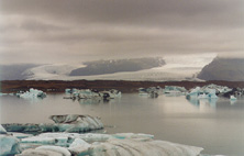 |
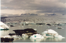
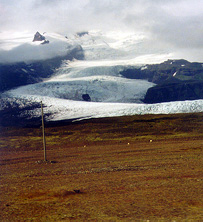
Breidamerjökull, one of the glacier tongues that descend from the Vatnajökull,
forms in its final part the lagoon of Jokulsarlon,
that communicates by a stright river less than 1 km long with the sea.
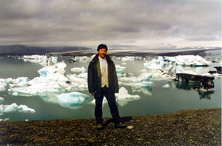
A service of boats allows to sail between icebergs that are come off the glacier,
approaching the front of it, in the middle of a majestic landscape.
| ||
 |
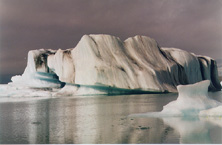 |
The volcanic ash thrown by the uncountless eruptions in the area, even underneath the glacier,
dyes of black the bluish ice colour.
| ||
 |
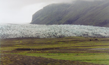 |
Throughout the way to Vik, we are almost able to hand-touch
the glacier tongues of the Vatnajókull from the bus. And that, next to the sea !
| ||
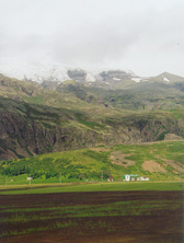 |
A farm with a dangerous fellow in the heights. | |||
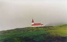 |
The churh of Vik. | |||
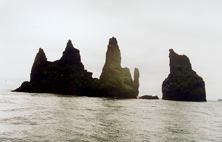 |
The rocks of Reynisdrangar, where thousands of frailecillos nest, wich we almost couln't watch to, because of our early return to the black beach of Vik, due to the the terrible sea disturbance. | |||
 |
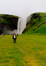 |
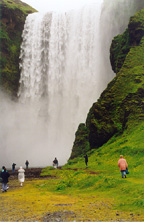
Skogafoss, a 60 mts high waterfall, in the Skogaa river.
The walls covered with an intense moss. Legends say that the settler Þrasi,
at the time of the Settlement, hid its gold armor behind the water curtain.
| ||
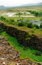 |
Thingvellir, sacred place where the Althingi, or Icelandic parliament, met during centuries,
in the edge of the Thingvallatn lake. In foreground, part of the fissure created by the separation
of Indo-European and American tectonic plates is seen. The fissure expands at a rate of about 2 cmt every year.
| |||
 |
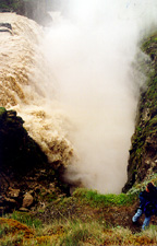 |
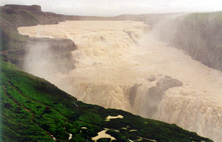
Gullfoss, the golden waterfall, in the Hvita river, one of the most sighted by tourists, due to
their relative nearness to Reykjavik. It has a 32 mts high fall in two steps,
and has formed a tube of 2.5 km and 70 ms of depth.
| ||
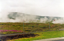 |
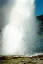
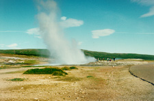
The steam of geyseres hide the visitors in the field of Geysir.
There are historical references from which geyseres of this place arose after
an earthquake in the south of the island in 1294.
| |||
 |
 |
 | ||
|
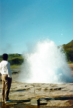
Every 5 or 7 minutes, geyser Strokur sends his steam spurt.
While, to its side, the Great Geysir, that gave name to the place, sleeps many years ago.
| ||||
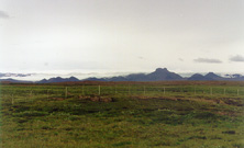 |
Asphalt finishes in Gullfoss. There begins one of the tracks for 4x4 vehicles that cross the inland of Iceland towards the North, only practicable in summer. It goes near the edge of Langjökull glacier, wich we can see in this picture, although confused with the sky overcast by clouds, behind the black mountains of Jarlhetur. | |||
|
|
|
|||