Around ICELAND (3)
 |
 |
 |
|
 |
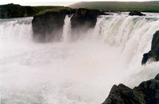 |
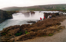
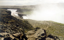
Godafoss, the waterfall of the Gods, from where, according to the Sagas,
the viking head �orgeir threw the pagan idols in A.D. 1000,
when Iceland became to the Christianity. It's not a very high waterfall, but it's one of finest of the country,
divided in two falls with form of horseshoe by a lava promontory in the center.
The lava field that causes the cascade comes from an eruption of Trolladyngja volcano 7000 years ago, 100 km far of the place.
| |
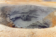 |
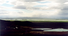
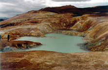
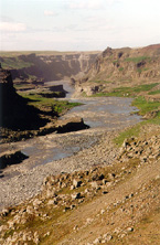
The area around the Myvatn lake is one of the geothermally most active places of the country.
You can observe plenty of manifestations: hot steam fumarolas, spurts, springs, or solfataras or boiling muds like this one.
| ||
 |
 |
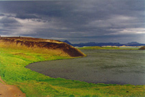
Explosive craters are observed along the lake borders. | |
 |
 |
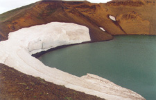
The Viti (Hell) crater in the NW slope of Krafla volcano.
9 eruptions in the zone have followed one another from 1975 to 1984,
throughout a 8 km long fissure.
| |
 |
 |
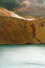
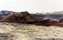
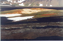
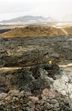
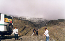
Fields of lava of different ages, still smoky, craters, lagoons of hot water, a zone in continuous volcanic activity.
We met several geologist teams in the area.
| |
 |
 |
Lava, snow, moss,... | |
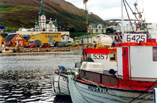 |
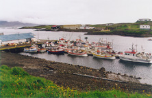
The harbour of Húsavík, from where the oak built fishing vessels leaves to the whale watching tour.
The whales are normally within a 45-minute sail from the
harbour towards the other side of the bay of Skjálfandi. Mainly Mink whales are seen.
| ||
 |
 |
A clear opens in the sky between clouds in the bay of Skjálfandi.
We sighted the whales in the proximities of the mountains that form the western border
| |
 |
Asbyrgi is a horseshoe form peculiar depression in an inmense lava field, of about 3.5 km long.
Its origin is uncertain; the more accepted theory attributes it to a gigantic instantaneous water
flow arisen after an eruption under glaciers, although the legend attributes it to the track of Sleipnir, the horse of Óðinn,
the father of the Gods. It reaches more than 100 ms of depth, and in its inner end forms this small lake in front of the vertical basalt walls.
| ||
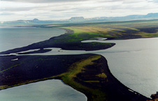 |
On black volcanic sands dragged by the rivers that form the beaches, form lagoons (Lon), like this in the bay of Oxarfjördur.
Moss colonizes slowly the black sands. | ||
 |
The impressive waterfall of Dettifoss, in the Jökulsá á Fjöllum. In order to appreciate the size,
it's enough to pay attention to the two people who walk in the footpath that lowers to the cascade.
| ||
 |
The glacial river Jökulsá á Fjöllum, that comes from the Vatnajökull icecap and the mountains of
Kverfjöll, is one of the greatest of Iceland (206 km long), and has built over time on the lava fields a
spectacular tube of 25 km (Jökulsárgljúfur). The West side lands constitutes a national park.
| ||
 |
 |
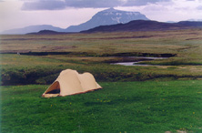
Hikers have encamped in the meadows around the farm of Möðrudalur,
one of most isolated of the country, as well as the highest located (469 ms).
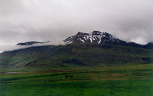
At the background, the huge mass of the Her�ubrei� (1682 mts) is sight,
with an almost circular base of 9 km, finished off by a crater.
A foreign traveller who visited the farm in 1814, told that the farm was so isolated
that none of the six children the farmers had, had never visited other farms,
although one of them had its own family already. Nowadays,
they serve coffee and cakes, and it's a must-stop when passing by these desertic lands.
| |
 |
 |
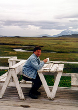
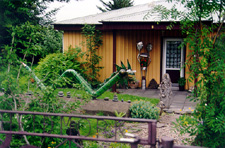
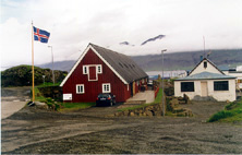
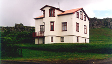
In Egilsstaðir (pop 1600), some houses have peculiar inhabitants. The second picture, a Lagarfljot view from my room in the Edda hotel, was taken at 2 a.m., handheld with the available light . Although the sun hasn't risen yet, it gives us an idea about the 'white nights' of Iceland at the time. . | |
 |
 |
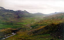
Breidalur, the greatest valley that cuts the mountains of the East of Iceland.
| |
 |
 |
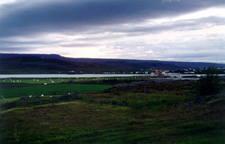
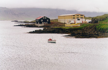
Djupivogur (pop 375), a commercial harbor since the XVI century, in the mouth of the Berufjördur,
a long fiord with many small barren islands and reefs, and beautiful riolita mountains at both sides,
with very little plain lands.
| |
 |
 |
 | |
| Djupivogur. | |||
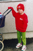 |
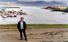
In Djupivogur, a little viking watches to us with curiosity, while it takes care of her little sister.
| ||
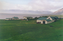 |
In the way to Höfn, farms like this one occupies the few lands that are left between the mountains and the sea.
| ||
 |
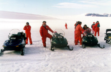 |
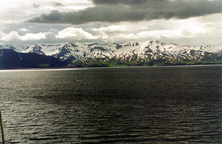
In Höfn, we settled in the Vatnajökull hotel, with fabulous views on the glacier and its tongues that scatter.
From there, we drove to the superior edge of the kálafelsjökull
to a mountain hut at 900 mts of altitude, in order to make a stroll in snowmobile by the glacier.
During the ascent on in a 4x4 bus, we could touch the lowest glacier tongues.
| |
 |
 |
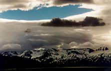
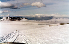
Up in the glacier, after crossing the cloud layer, we had a beautiful weather. The huge glacier, 10,000 km2 of extension,
has its higher peak in Havannadalshnúkur (2119 mts).
| |
|
|
|
|
|